
TÜRKİYE ARCHIVE · GEOGRAPHIC CONTEXT
Edirne
The markers show geolocated archive records. No estimated coordinates have been assigned to new images whose camera locations are unknown.Search the recorded place name on the map ↗
Loading records…
 Date unknown
Edirne II. Beyazıt Mosque and Environment / Basile Kargopoulo Photo
41.6759, 26.5587
 1878
Edirne, 1878
41.6759, 26.5587
 1878
Edirne, 1878
41.6759, 26.5587
 Date unknown
Selimiye Mosque, Edirne/19th Century
41.6759, 26.5587
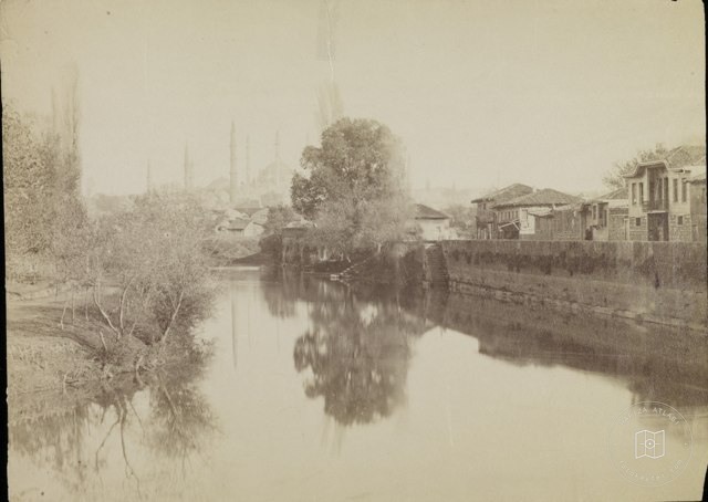 Date unknown
Edirne / 19th century
41.6759, 26.5587
 1885–1910
The Mansion of the Palace in Edirne / 1885-1910
41.6759, 26.5587
 1916
Edirne 1916
41.6759, 26.5587
 1916
Edirne 1916
41.6759, 26.5587
 1916
Edirne 1916
41.6759, 26.5587
 1916
Edirne 1916
41.6759, 26.5587
 1916
Edirne Meriç Bridge / 1916
41.6759, 26.5587
 1916
Edirne 1916
41.6759, 26.5587
 1916
Edirne 1916
41.6759, 26.5587
 1916
Edirne 1916
41.6759, 26.5587
 1916
Edirne 1916
41.6759, 26.5587
 Date unknown
Long Beach, Edirne
41.6759, 26.5587
 1910–1919
Edirne in 1910
41.6759, 26.5587
 1900–1909
Edirne in 1900
41.6759, 26.5587
 1930–1939
EdirneMQ Uzunköprü in 1930s
41.6759, 26.5587
 Date unknown
Gazimihal Bridge, Edirne
41.6759, 26.5587
 Date unknown
Mosque, Havsa - Edirne
41.6759, 26.5587
 1912
Avenue, Edirne/1912
41.6759, 26.5587
 1912
Edirne / 1912
41.6759, 26.5587
 1960
Alipaşa Market, Edirne / 1960
41.6759, 26.5587